The evolution of baseball stadiums mirrors suburban sprawl, housing inequality, and the infrastructure choices that shaped modern North America.
Baseball is a strange cultural artifact. On its surface, it is disarmingly simple. A bat, a ball, ninety feet between bases. Long pauses punctuated by brief explosions of action. It is slow, repetitive, almost absurdly minimal in its mechanics. And yet, layered on top of that simplicity is an industry worth billions, wrapped in civic identity, real estate speculation, broadcast empires, and public financing battles.
That contradiction is part of what makes the sport so compelling. Something so structurally basic carries enormous symbolic and economic weight. Entire city identities hinge on teams. Municipal budgets bend around stadium financing. Neighborhoods rise or fall based on proximity to ballparks.
To understand this paradox, you have to look beyond the game itself and toward the land it occupies. Baseball stadiums are not neutral entertainment sites. They are physical expressions of political priorities — about transportation, housing, capital investment, and who cities are ultimately built for.
Nowhere is that more visible than in the vast landscapes of asphalt that surround many modern ballparks.
The Dodger Stadium Template
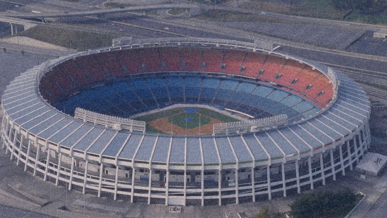
Few places illustrate the spatial absurdity of modern stadium design like Dodger Stadium. Perched above downtown Los Angeles in Chavez Ravine, the ballpark is encircled by one of the largest parking complexes in professional sports. The sheer acreage devoted not to the game itself, but to storing cars, is staggering.
From the air, the ratio becomes disorienting. The stadium structure — the place where baseball actually happens — occupies only a fraction of the total footprint. The rest is asphalt. Layer upon layer of parking lots stretching across hillsides.
Urban planners and housing advocates often point out the uncomfortable arithmetic: the land dedicated to parking alone could accommodate tens of thousands of housing units, depending on density models. Even conservative estimates suggest capacity for entire residential districts.
This spatial allocation becomes especially jarring when placed alongside Los Angeles’ housing crisis. One of the wealthiest metropolitan regions in the world contains vast tracts of land reserved for eight hours of intermittent parking use, while tens of thousands of residents remain unhoused.
The contrast exposes a deeper infrastructure logic. Modern stadiums are not built around people; they are built around cars. Accessibility is measured in highway lanes rather than transit lines. Land is valued for vehicular throughput rather than residential capacity.
Visitors from cities with transit-oriented planning — parts of Europe or East Asia, for instance — often react with disbelief. The idea that such centrally located land would be given over to parking at this scale feels not just inefficient but morally disorienting.
Dodger Stadium becomes more than a ballpark. It becomes a monument to late-20th-century planning ideology: entertainment prioritized over housing, automobiles over walkability, spectacle over social need.
Downtown Origins: Baseball’s Urban Roots
This was not always the spatial logic of baseball.
The sport was born in the dense industrial cities of the Northeastern United States. Early ballparks were embedded directly into urban neighborhoods. Land was scarce, transit was rail-based, and spectators arrived on foot, streetcar, or train.
Ballparks were woven into the fabric of daily life. They sat beside apartment blocks, corner bars, storefronts, and factories. Game days spilled directly into surrounding streets. The stadium was not an island; it was a node within an existing urban ecosystem.
Neighborhood identities fused with team identities. Fans didn’t just go to games — they inhabited the districts that surrounded them. The experience extended beyond nine innings into taverns, restaurants, and stoops.
This integration produced ballpark districts that felt alive even outside game hours. The stadium did not create the neighborhood; the neighborhood created the stadium experience.
It is a fundamentally different spatial philosophy from the isolated complexes that would emerge later.
The Suburban Ballpark Shift
The rupture began after World War II, as the spatial logic that once anchored baseball in dense urban neighborhoods gave way to the forces reshaping North America itself. As cities suburbanized, professional sports followed the population shift outward. Cheap peripheral land, expanding highway systems, and the growing dominance of the automobile made suburban stadium construction economically attractive in ways inner-city sites no longer were. Rather than building within tight downtown grids, franchises could acquire massive tracts of land on metropolitan edges, where parking capacity could be maximized and traffic managed through freeway interchanges instead of transit hubs.
Geographically, this pattern often tracked the same westward developmental arc that defined broader American expansion. Older teams in the Northeast and Eastern Midwest retained their urban ballparks largely due to historical inertia and land scarcity. But newer franchises, particularly across the Sunbelt and West Coast, embraced the suburban mega-complex model. What emerged was the “event island” stadium — facilities surrounded by seas of parking, disconnected from surrounding neighborhoods, and activated only during games or concerts. Outside event hours, these zones frequently lapsed into spatial dead space.
This transformation mirrored wider postwar planning trends: automobile dependency replacing rail-based transit, single-use zoning supplanting mixed-use density, and abundant peripheral land enabling horizontal sprawl. In the process, the ballpark was fundamentally redefined — shifting from a civic neighborhood anchor embedded in everyday urban life to an isolated entertainment enclave shaped by the infrastructural priorities of the suburban age.
Integration and Isolation
Historic parks like Fenway Park and Wrigley Field remain the clearest surviving examples of baseball’s original urban model. At Fenway, the stadium feels inseparable from Boston’s street grid, woven tightly into the surrounding cityscape. Lansdowne Street’s bars, music venues, and narrow pedestrian corridors operate as natural extensions of the ballpark itself, blurring the boundary between game space and neighborhood life. A similar dynamic exists in Chicago’s Wrigleyville, where residential buildings, rooftop seating, taverns, and storefronts wrap closely around the field. The stadium does not stand apart from the district — it is structurally and culturally embedded within it.
What distinguishes these historic parks is that they did not require manufactured entertainment zones. Their surrounding cultures accumulated organically over decades through repetition, habit, and community investment. Restaurants, transit stops, street vendors, and fan rituals became infrastructural layers built into the neighborhood fabric. The result is an authenticity that cannot be easily replicated through top-down planning.
By contrast, newer or redeveloped sites operate differently. Toronto’s Rogers Centre, while centrally located and well-served by public transit — a significant advantage over suburban facilities — exists within a largely master-planned entertainment district. Corporate developments, condominium towers, and chain establishments generate activity, but the area often lacks the historical layering and vernacular character that define older ballpark neighborhoods.
Ottawa presents an even starker spatial model. The Canadian Tire Centre sits in suburban Kanata, physically removed from the city’s downtown core. Limited transit access and its distance from nightlife and hospitality districts have long drawn criticism from fans and planners alike. While the arena functions efficiently as an event venue, it struggles to operate as a broader civic gathering space integrated into urban life.
Taken together, these examples illustrate three distinct stadium typologies: organic urban integration, as seen in Fenway Park and Wrigley Field; planned urban placement, represented by Rogers Centre; and suburban isolation, exemplified by the Canadian Tire Centre. Each reflects a different planning ideology, shaped by land economics, transportation infrastructure, and the historical moment in which the facility was built.
Stadiums as a Map of Urban Ideology
When viewed collectively, stadium geography begins to read less like a collection of sports venues and more like a physical map of North American urban development. The earliest ballparks reflect the conditions of industrial urban density: transit-based accessibility, walkable street grids, and deep social integration within working neighborhoods. By contrast, the wave of mid-century stadium construction and relocation tracks almost perfectly alongside suburban expansion, privileging car-oriented access, land abundance, and spatial separation from surrounding communities.
This progression mirrors a series of broader historical forces that reshaped the continent in the postwar period. Highway construction reoriented mobility around automobiles rather than rail. White flight hollowed out urban cores while accelerating suburban growth. Municipal tax bases migrated outward, altering public financing priorities. At the same time, cities began competing to attract or retain franchises through public subsidies, often leveraging peripheral land where large-scale development was easier to execute.
Franchise relocations themselves frequently followed demographic and economic growth corridors, chasing population booms, television markets, and real estate opportunity. In this sense, stadiums operate as infrastructural fossils, preserving within their footprints the planning ideologies dominant at the time they were built. A downtown brick ballpark evokes the era of rail cities and immigrant labor districts, while a concrete complex ringed by parking reflects the ascendancy of postwar automobile capitalism. Neither landscape is accidental; each is the product of deliberate political, economic, and spatial decisions embedded in the built environment.
Baseball as Infrastructure Politics
It is tempting to treat stadiums as cultural novelties — sites of leisure detached from everyday life. But their placement, scale, and financing reveal deeper civic priorities.
A stadium surrounded by parking lots signals a city built for cars. A stadium embedded in housing and transit signals a city built for people. A stadium built on publicly subsidized land during a housing crisis signals political choices about whose needs take precedence.
Baseball’s spatial evolution tracks the evolution of North American urbanism itself — from dense industrial cores to sprawling automobile peripheries, from neighborhood integration to entertainment zoning.
The game may remain beautifully simple. But the landscapes constructed around it are anything but.
In the end, baseball stadiums are not just places where games are played. They are monuments to how cities distribute land, capital, and belonging — physical scorecards of the values that shaped them.